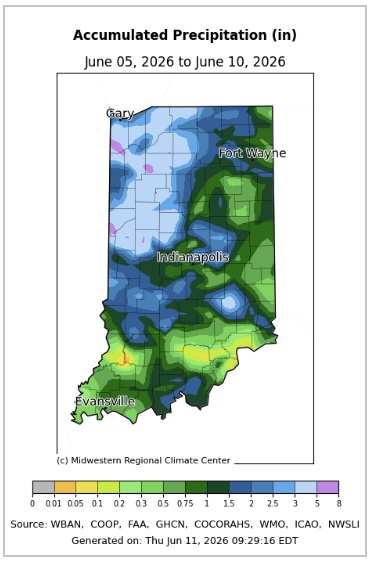
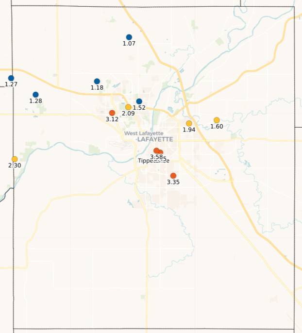
Since last Friday, many parts of Indiana have seen a significant amount of rain (Figure 1). However, the spatial variability illustrates how there can never be enough ground observations and measurements to tell the entire story. In a 24-hour period over the weekend, an observer in Lafayette, Indiana recorded 3.58” and yet 3 miles to the northeast, other CoCoRaHS observers measured less than 2.00”. Less than 10 miles to the northwest, those CoCoRaHS observers measured less then 1.25” (Figure 2)! These differences play a huge role in knowing where there might be flooding, where drought may still be a problem, and where National Weather Service precipitation radar algorithms may need to be improved. If you’re not already a volunteer CoCoRaHS observer, please consider signing up (https://cocorahs.org). With a manual 4” rain gauge, you can help provide data to the scientific knowledge of rainfall, rainfall impacts, and infrastructure development for your area!
All the rain is due to both increasing temperatures (added energy and therefore rising air) and increasing moisture flowing northward from the Gulf. Now that the ground has become well saturated in most areas and vegetation is thriving (if it is not drowning), evapotranspiration has been adding even more humidity to the air. Say hello to hot and muggy conditions! Dew point temperatures – the temperature the air would need to cool down to for the air to become saturated and condensation to occur – was around 70°F by the middle of this past week. Yikes! That will make nighttime air feel so damp and sticky. Cooler temperatures start moving into our area by Friday with dew point temperatures dropping into the upper 50s and lower 60s. That is still considered quite humid, but many will find this welcoming.
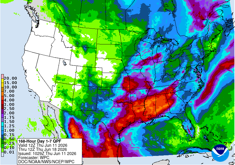
Indiana will remain in this rainy pattern for at least another week, with the forecasted 7-day totals ranging from 0.5” (eastern / southeastern Indiana) to almost 2.0” (northwestern Indiana) (Figure 3). Beyond that, climate outlooks are slightly favoring cooler than normal temperatures with the possibility of above-normal precipitation. There is a slight risk for a heavy precipitation event sometime around June 18-20.
-
- Figure 1. Precipitation totals reported since the morning of June 5 through June 10, 2026.
-
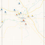
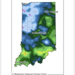
- Figure 2. 24-hour precipitation totals reported the morning of June 7, 2026 from volunteer CoCoRaHS observers in Tippecanoe County, Indiana.
-
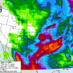
- Figure 3. 7-day precipitation totals forecasted for the evening of Wednesday, June 10th through the evening of June 17, 2026.