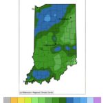
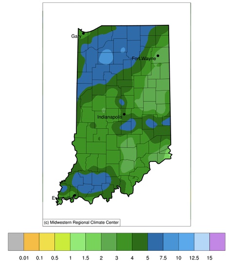
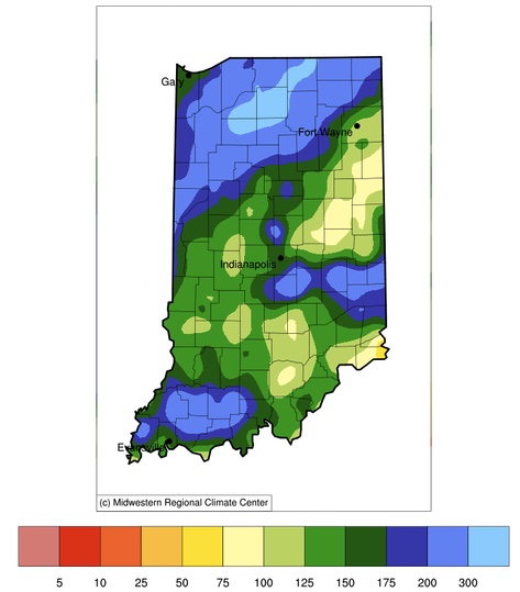
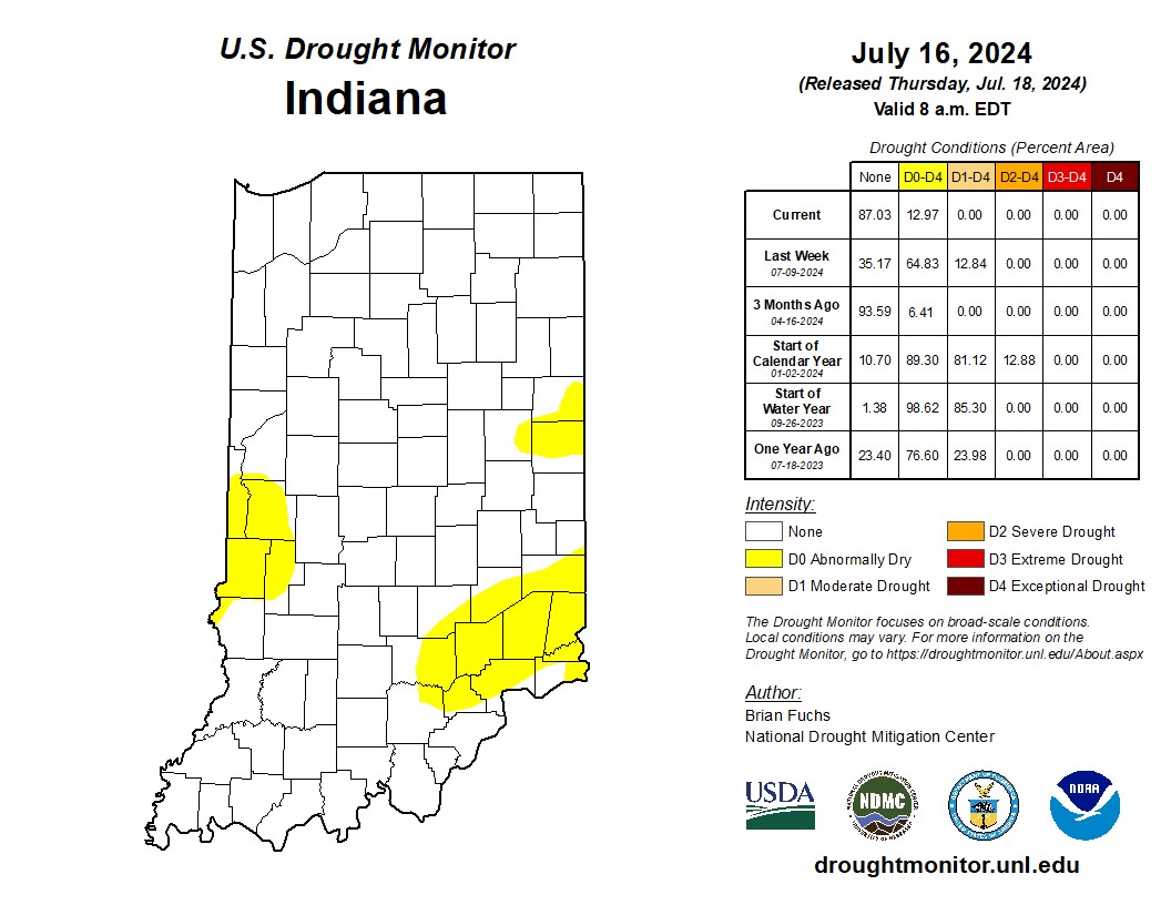
Since the start of July, most of Indiana has received at least 2 inches with up to 8 inches of precipitation (Figure 1). Except for southeastern and east-central Indiana, this precipitation has been well above normal (Figure 2). As a result, most locations have seen an improvement in the U.S. Drought Monitor (Figure 3). There are only a few counties categorized as Abnormally Dry (D0) with the rest of the state considered to be in No Drought status. The recent storms, however, brought a wide range of impacts from power outages and flooding, to downed trees and structural damage, to even a preliminarily designated tornado or two (still under official assessment). We hope that everyone made it through the events safely and any impacts to agricultural production were minimal.
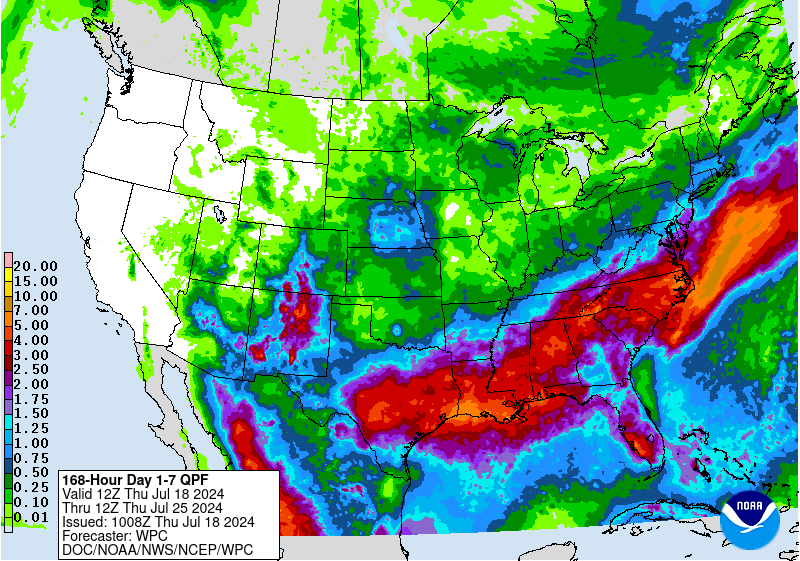
Looking ahead, things should stay dry throughout the weekend with a chance of rainfall returning the first half of next week. Southern and eastern Indiana should benefit the most from those upcoming events. Over the next few weeks, temperatures are expected to stay near normal with a slight probability of above-normal precipitation.
-
- Figure 1. Total precipitation from July 1-17, 2024 in inches.
-
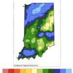
- Figure 2. Percent of the 1991-2020 climate normal period for rainfall that fell from July 1-17, 2024.
-
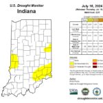
- Figure 3. U.S. Drought Monitor for data through Tuesday, July 16, 2024.
-
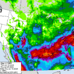
- Figure 4. Forecasted precipitation total (inches) for July 18-25, 2024.