Happy meteorological summer, everyone! Whether you’re ready or not, summer is here…well, at least meteorologically. While the official start of summer according to the astronomical calendar is the summer solstice on Thursday, June 20, meteorological summer began on June 1. This distinction is important because meteorological seasons are based on annual temperature cycles and divide the year into four equal parts, allowing climatologists to compare data over consistent time periods each year. Meteorological summer includes the months of June, July, and August.
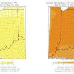
May concluded with a preliminary average temperature of 66.5°F for Indiana, which is 4°F above the normal average. Statewide, average temperatures ranged from 2°F to over 6°F above normal (Figure 1). SHOALS 8S, located in Martin County, recorded the highest deviation, averaging 6.5°F above normal with an average temperature of 71.7°F, making it the warmest location in the state by 0.8°F. PATOKA LAKE in Dubois County recorded the highest maximum temperature for May in the state on May 20, with a high of 94°F (only considered stations with 100% data reporting).
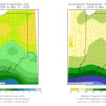
Indiana’s preliminary precipitation total for May was nearly normal, averaging 4.92 inches statewide, just 0.14 inches above normal. Precipitation varied widely, with areas receiving between 75 percent and over 125 percent of normal totals (Figure 2). NEWBURGH 1.3 ENE in Warrick County recorded the highest precipitation in May, measuring 9.12 inches. DE MOTTE 0.8 NNW in Jasper County, measured 4.44 inches on May 21, the second highest daily total for that station since 2008 (only considered stations with 100% data reporting).
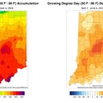
Since the beginning of June (June 1-4), temperatures have been around normal, while precipitation has been below normal for most of north-central Indiana. These recent conditions have allowed producers to catch up on field activities. As of June 2, the USDA NASS Crop Weather Report indicated that 87 percent of corn and 81 percent of soybeans have been planted, both of which are above their respective 5-year averages. Due to the above-normal temperatures, growing degree days (GDDs) have continued to track above normal since April 1 (Figure 3). GDD accumulations ranged from 300 to over 650 units across the state, which was 40 to 150 GDDs ahead of schedule.
Looking ahead, temperatures are expected to be pleasant over the coming days, ranging from the 70s to 80s, with slight chances of scattered precipitation. The Climate Prediction Center (CPC) expects below-normal temperatures and slightly below-normal precipitation from June 10-14. Towards the middle of the month, the CPC continues to predict below-normal temperatures and near-normal to below-normal precipitation.
- Figure 1: (Left) Average temperatures for May 2024. (Right) Average temperatures for May 2024, represented as the departure from the 1991-2020 climatological average.
- Figure 2: (Left) Precipitation accumulations for May 2024. (Right) Precipitation accumulations for May 2024, represented as the percent of the 1991-2020 climatological average.
- Figure 3: (Left) GDD accumulations from April 1-June 4, 2024. (Right) GDD accumulations from April 1-June 4, 2024, represented as the departure from the 1991-2020 climatological average.


