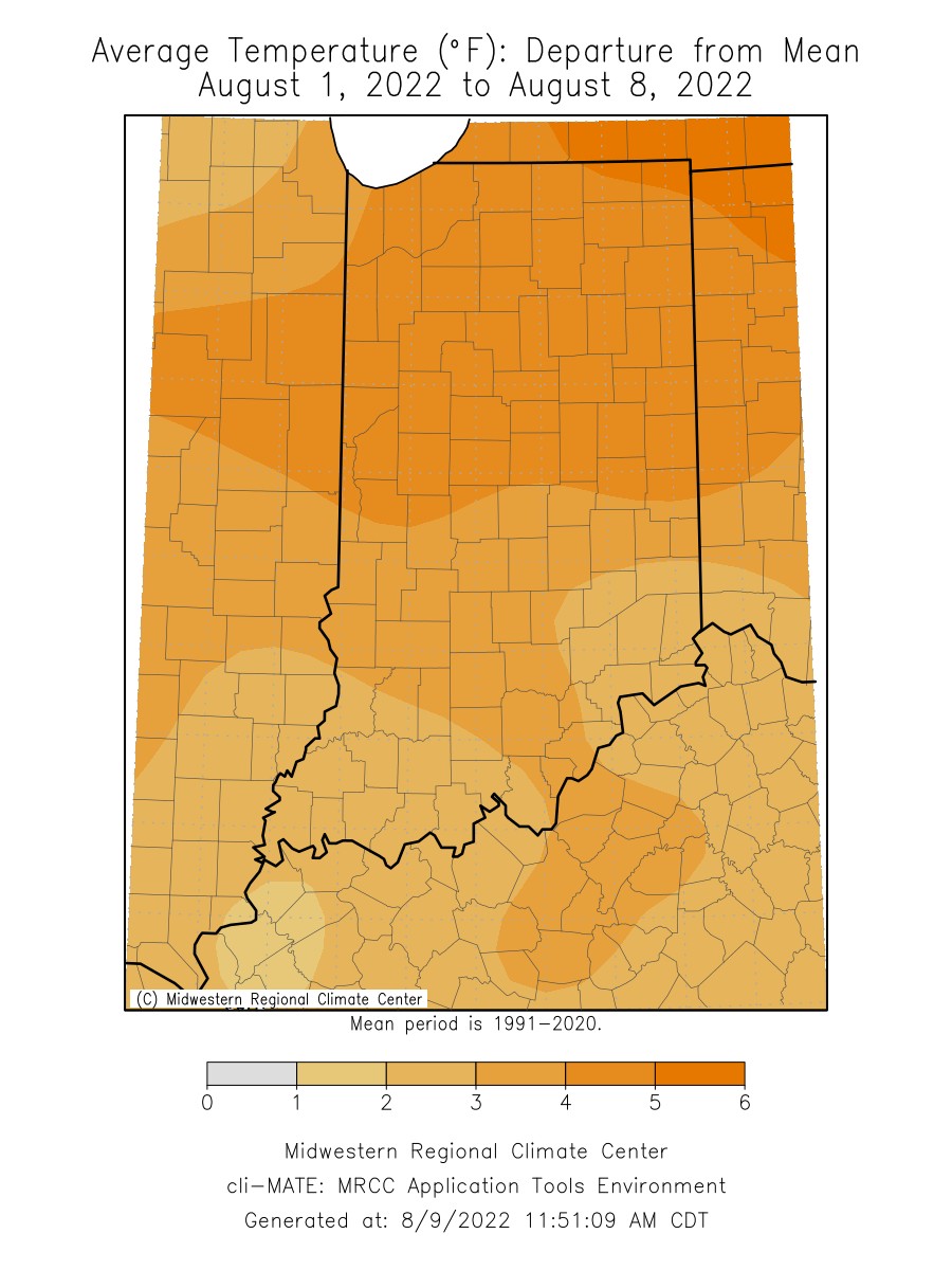
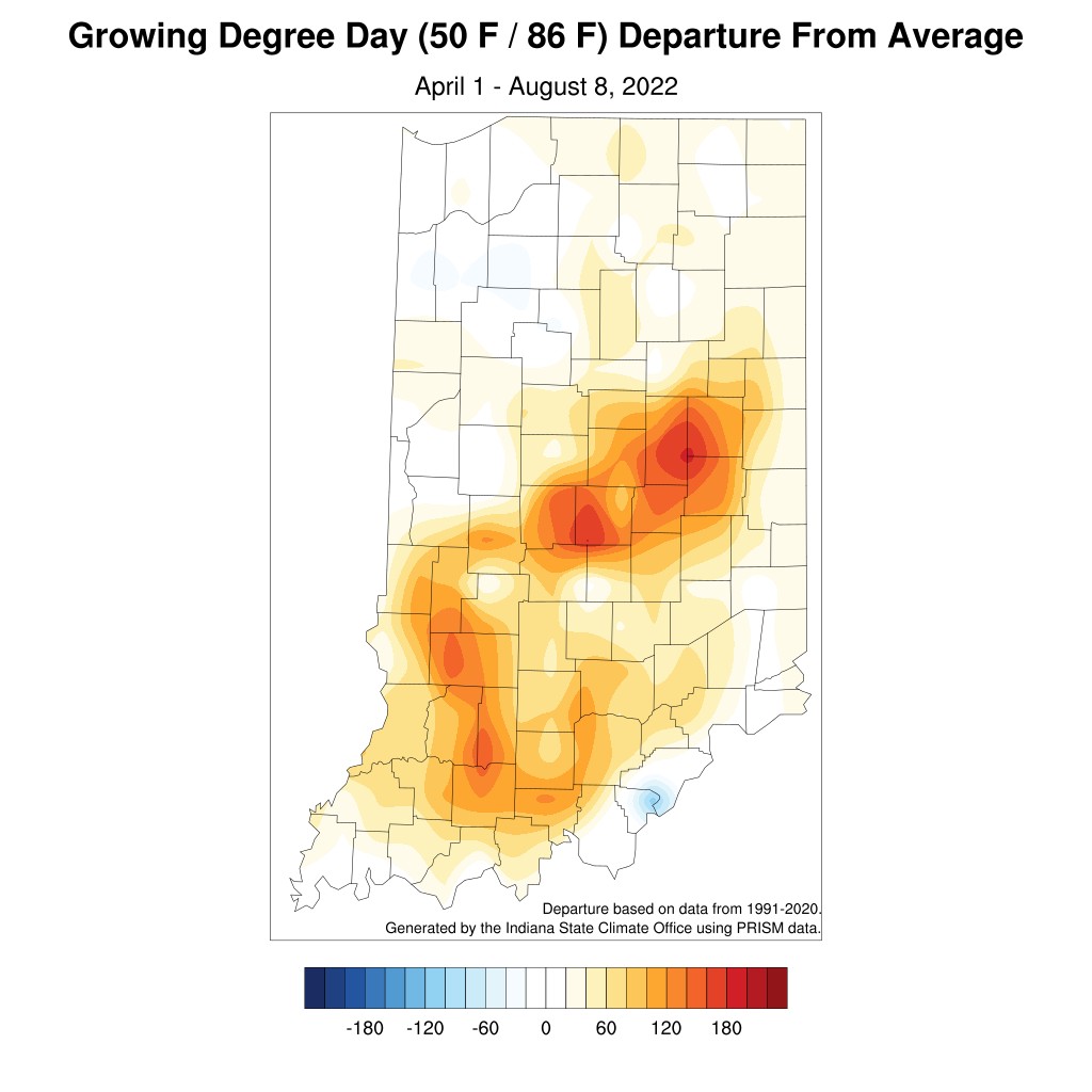
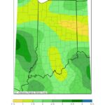
July temperatures averaged 1◦F above normal but had a couple of periods of extreme heat. Twelve stations recorded maximum temperatures in excess of 100◦F. Portions of the month were cooler than normal, which gave way to warmer temperatures again in the last week of July. The heat and humidity continued during the first week of August, as the entire state experienced temperatures ranging from 4-6◦F above normal. Northern Indiana measured the warmest temperatures, ranging from 5-6◦F above normal (Figure 1). Statewide, minimum temperatures were 3-6◦F above normal to start the month. There were regional differences in maximum temperatures as southern Indiana was near normal and northern Indiana was nearly 6◦F above normal for the week. The Lafayette Purdue University Airport had an average maximum temperature of 90◦F, with the highest temperature reaching 95◦F on August 3rd. A cold front brought cooler weather to the northern part of the state on August 9th, with maximum temperatures in the mid to upper 70s. Since April 1, Modified Growing Degree Days (MGDDs) have tracked above normal for most of the state. Central and southern Indiana show the highest MGDD departures with some spots running 120-180 units above normal (Figure 2).
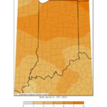
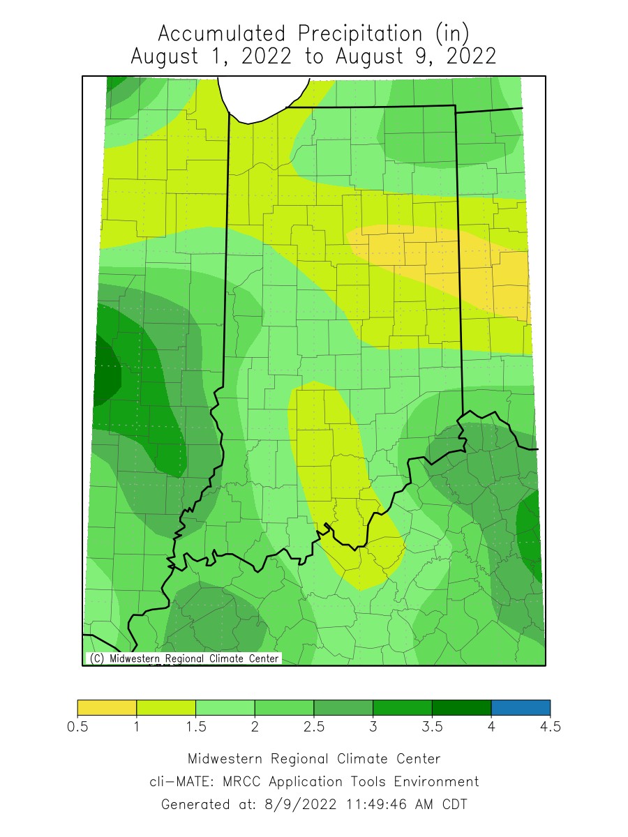
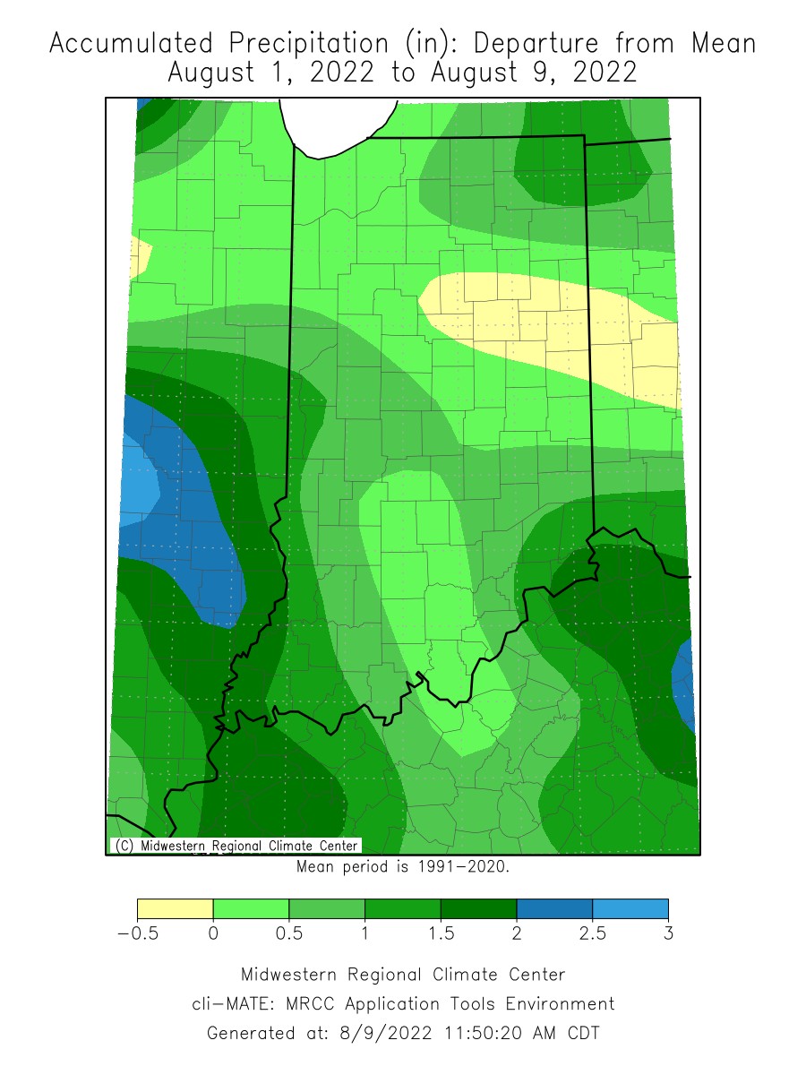
Through the first eight days of August, precipitation was above normal for most in the state. Indiana averaged 1.33 inches of rain, which was 0.25 inches above normal. Precipitation totals for northern and southern Indiana were over an inch (Figure 3). Southwestern Indiana averaged 1.89 inches of rain, which was 0.68 inches above normal for the week (Figure 4). There were areas with extreme precipitation, including Patoka Lake which measured 6.01 inches of rain (3.82 inches fell on August 6th). As a result, many of the stream gauges in southwestern Indiana averaged above-normal stream flows. Conversely, central Indiana was 0.13 inches below normal, with many locations totaling just over a half inch. Due to the ongoing drought, many of the stream flows in central Indiana remained below normal. On the August 2nd US Drought Monitor, the area affected by Moderate Drought (D1) was reduced slightly but continued for west-central Indiana (Figure 5). Abnormally Dry (D0) conditions continued through central Indiana. Additional improvements are expected in the August 8th US Drought Monitor.
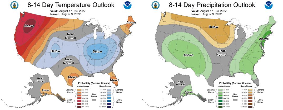
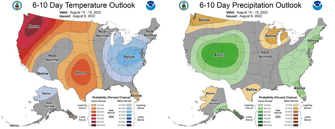
Turning focus to what’s ahead, the 6-10 day Climate Prediction Center (CPC) Outlooks (August 15-19) have higher confidence in below-normal temperatures and near-normal precipitation is expected (Figure 6). The 8-14 day CPC Outlooks (August 17-23) continue this trend (Figure 7).
-
- Figure 1: Average temperature in degrees Fahrenheit for August 1-9, 2022, represented as the departure from the 1991-2020 normal temperature during that period.
-

- Figure 2. Modified Growing Degree Day (MGDD) (50◦F/86◦F) accumulation from April 1-August 8, 2022, represented as the departure from the 1991-2020 climatological average.
-
- Figure 3. Accumulated precipitation (inches) from August 1-9, 2022.
-
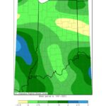
- Figure 4. Accumulated precipitation from August 1-9, 2022, represented as the departure from the 1991-2020 normal precipitation that fell during that period.
-
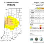
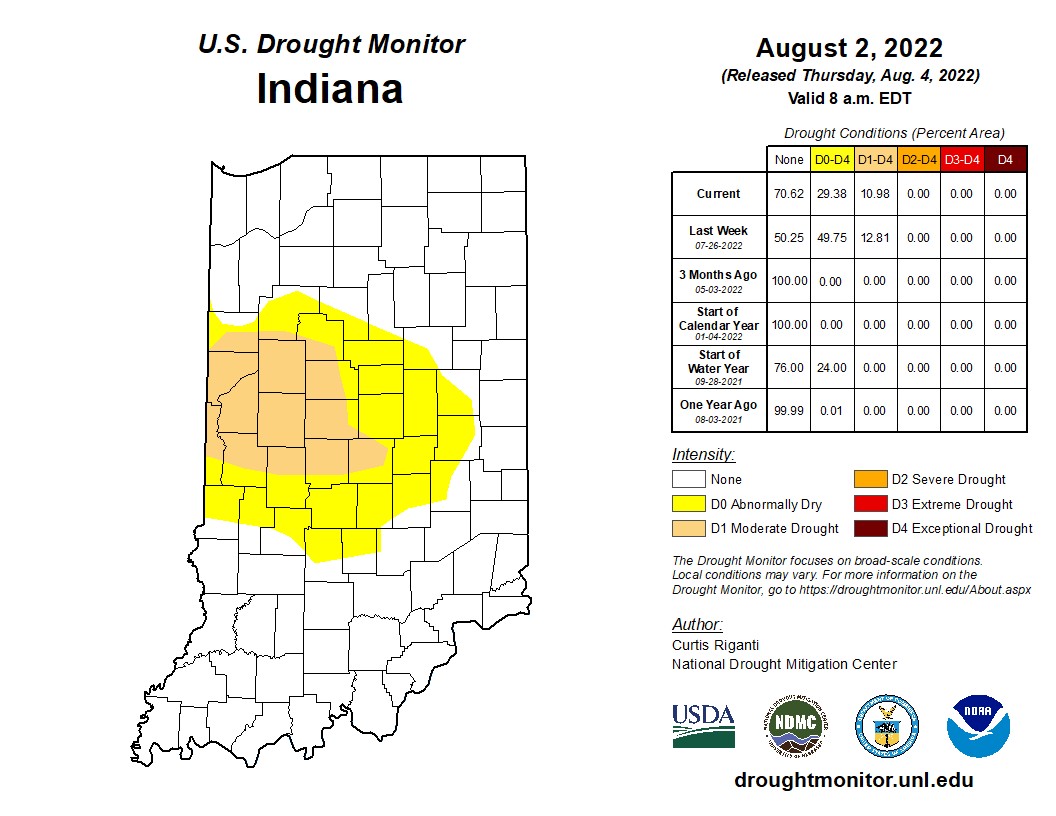
- Figure 5. Indiana US Drought Monitor from August 2, 2022.
-
- Figure 6. The CPC’s 6-10 day temperature (left) and precipitation (right) outlooks for August 15-19, 2022.
-
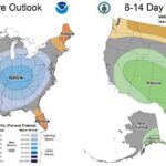
- Figure 7. The CPC’s 8-14 day temperature (left) and precipitation (right) outlooks for August 17-23, 2022.